| Willmore Wilderness Park, A Photography Slideshow | Map showing hike along the Wildhay Ridge (our name for it) | | return to start | Maps & Information | next-> | |
|
|
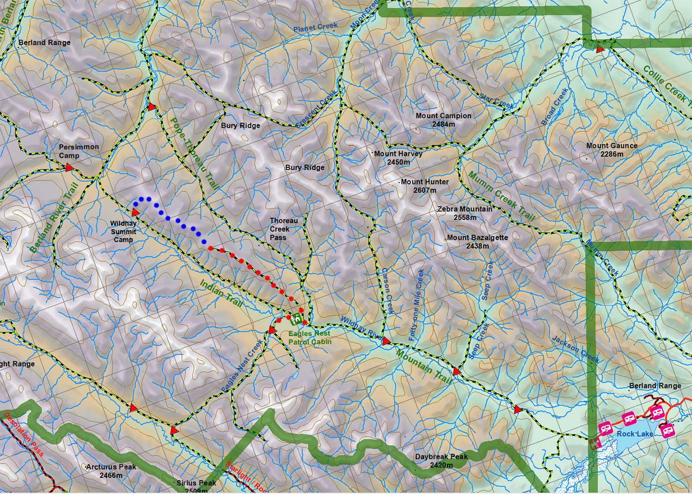
| This is one of the most stunning hikes in Willmore, if not the Canadian Rockies. Follow the 8 km of this gentle ridge from one end to the other and you'll have an understanding why I call Willmore "Walking in the Sky" country. The Wildhay Ridge runs paralled to teh Wildhay Valley. The traditional Indian Trail follows the valley bottom. There's a good trail going up to the top starting across from the Eagle's Nest patrol cabin. I've used the red dots to show the trail where it exists. It runs out about halfway along the ridge. The blue dots are an easy hike and the cross country route at the end takes you to a camp at the summits of the Wildhay River. Go over the divide and you're dropping down to the South Berland River. |
|
| Home | Email | About This Website | Image Sales & Copyright | |